More About Horseshoe Bend, Page, Arizona
Take a trip to:
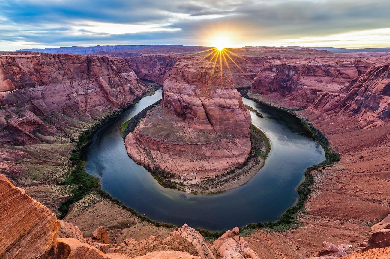
Horseshoe Bend, Page, Arizona
Horseshoe Bend is a horseshoe-shaped incised meander of the Colorado River located near the town of Page, Arizona, United States. It is also referred to as the "east rim of the Grand Canyon."
A social media darling, Horseshoe Bend has become one of the most recognized and visited places in Glen Canyon National Recreation Area. The parking lot and trailhead is located off US Highway 89, approximately 5 miles (8 km) south of the Carl Hayden Visitor Center.
Changes are underway in this busy and beautiful place, including expanded parking and trail maintenance. Please respect construction closures. Much of the rim remains exposed, so watch your footing and keep track of children.
Hiking
The hike to the overlook is 1.5 miles (2.4 km) round-trip over a hardened path. The trail is accessible under the regulations of the Americans with Disabilities Act. There are two shade structures along the length of the trail, but not at the overlook. There are railings at the edge of the overlook's viewing platform, but not along the trail.
As with any hike, be prepared with plenty of water, sturdy footwear, sunscreen, and other basic hiking essentials. Know that there is little shade along the Horseshoe Bend Trail. Avoid hiking during the hottest part of the day.
Horseshoe Bend has been featured as a landmark for Glen Canyon National Recreation Area, Grand Canyon National Park, the Cities of Page AZ, Kanab UT, St George UT, and the Navajo Nation. Boundary lines are very close in some places. Horseshoe Bend itself, and that part of the Colorado River, are a part of Glen Canyon National Recreation Area. About nine miles downstream is where Grand Canyon National Park begins. US Highway 89, the land north of the trail to the Horseshoe Bend overlook, and the parking area for the trailhead are in the City of Page. The land south of the parking area and the trail and overlook are on the Navajo Nation. This mixture of jurisdictions provides a unique opportunity in the management of this magnificent trail and overlook.
An Entrenched Meander
Below the rim, the Colorado River makes a wide sweep around a sandstone escarpment. On its long downward journey to the sea, the river meandered, sometimes making wide bends, but always seeking the path of least resistance. Around 5 million years ago, the Colorado Plateau uplifted and the meandering rivers that crossed the ancient landscape were trapped in their beds. Over time, the rivers cut through the uplifted layers of sandstone.
Here at Horseshoe Bend, the Colorado River created a roughly 1,000 ft (305 m) deep, 270º horseshoe-shaped bend in Glen Canyon.
Did you know you can follow any of our 175 Special Interest calendars and stay informed better than ever before? See them here. You can also create your own public or private calendar here. Post events to your calendar and ours at the same time! Terms and conditions may vary based on the policies of your local Town Planner publisher.
To learn more, watch our intro video!